


Reflecting on the genesis of Treasure Island, the adventure yarn that grew from a map of an exotic isle he had drawn to amuse a bored schoolboy on a rainy day, Robert Louis Stevenson observed: ‘I am told there are people who do not care for maps, and I find that hard to believe.’ It’s fair to say that Thomas Reinertsen Berg cares very deeply about them, and his book, sumptuously produced with lots of full-colour images, is a kind of potted treasury of cartographical history that gleams with pieces-of-eight-like snippets of information.
With a title that tips its hat to Theatrum Orbis Terrarum, the first modern atlas produced by the Flemish cartographer Abraham Ortelius in 1570, Thomas Reinertsen Berg’s approach is both impressively global and touchingly parochial, as his native Norway and Scandinavia in general often and unashamedly take centre stage in the narrative. (A note in the foreword explains that the book has to a certain extent been de-Norwegianised for the English edition.)
But it is, in a sense, a work of thoughtfulness that could only really come from someone who hails from a part of the world that was either off the global map entirely or the victim of some decidedly wayward speculations by cartographers. He notes, for instance, that if the Hereford Mappa Mundi, created in about 1300, contains possibly the first convincing representation of a ski trail, certain areas at the northern extremities are still shown to be inhabited by ‘people with dog heads’.
Norway, you come to appreciate, has in any case been a tricky country to map. For a start, there’s its basic geography, the coastline and all those mountains, rivers and fjords. And then it was a Danish colony for more than 400 years and after that spent close to a century shackled to Sweden. In more recent times, the discovery in the 1960s of (potentially) oil- and gas-rich deposits of sedimentary rock off its coast caused its government to extend the country’s sovereign boundaries out into the ocean, claiming precious seabed and subsoil in the process. It perhaps says as much about the particular importance accorded maps by Norway that the first survey in a scheme to chart the nation’s economic activity geographically, initiated in 1964, was only completed in 2002.
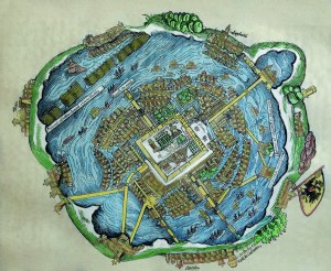
Maps, though, as the author illustrates, are always as much about the people and the societies that produce them as the terrains they depict. This also makes determining whether or not some of the earliest examples we have are actually maps such a thorny issue. He cites the ongoing disputes over the 9,500-year-old cave painting excavated at Çatalhöyük in Turkey in 1967 and described in some quarters as ‘the oldest town plan in existence’. Too little is known about the prehistoric culture that produced it to definitely say if it’s a map or merely a nice painting of the local scenery to brighten up a dull cave wall.
Like language in Wittgenstein’s view, use is largely the determining factor with maps; and necessity, inevitably, the mother of their invention. Whether to help assign property rights in Ancient Sumeria and Babylon, or to work out compensation payments for flood damage by the Nile in Egypt, or looking to invade Persia if you are the Spartans, or running much of the world if you are the Roman Empire, or hoping to maintain Christ’s rule on earth as the established church in the Middle Ages, some sort of map is necessary, as Reinertsen Berg diligently outlines.
He also proffers some choice examples of how those with better maps triumphed over those with poorer ones. In the 15th century, secretive Spanish and Portuguese imperial navigators, hoarding information about their maritime routes like Incan gold, clung on to their hand-drawn nautical charts. They were duly to be out manoeuvred by the free-booting Dutch, who sailed with the latest and most up-to-date maps, usually internationally crowd-sourced, and expertly printed in Antwerp. Still, cartographical mistakes have also helped expand our horizons; it’s likely that Columbus may never have set off to the New World if he had not plotted his voyage using a globe by the German mariner Martin Behaim. Created in 1492 on principles derived from Ptolemy’s only recently rediscovered Geography, Behaim’s globe is the oldest surviving example in Europe; it is also flawed, as he underestimated the size of the earth and ‘placed Japan around where Mexico is located’. But this error encouraged Columbus to believe that Asia could ‘easily be reached by ship from Europe’.
Equally, innovations in mapping were frequently resisted; Mercator’s famous projections and his Atlas, we learn, were, if more accurate, initially flops as they were too austerely drawn for their times. An earlier series he published on the Balkans, Greece and Italy featured just ‘one monster and two ships across a total of 21 maps.’ It was only posthumously that sales rose, after Hondius the Elder larded Mercutor’s Atlas with ‘extravagant, baroque illustrations of people in national costume’ and ‘more ships’.
Inevitably in a book that moves briskly from prehistoric stone carvings to Google Earth, there are omissions. Curiously there is nothing here on transport maps or the humble A-Z, but then that might say more about my own geographical biases. The theatricality in the title also extends to rendering scenes from the map-makers’ lives quasi-novelistically in the present tense (‘With her brush, Anne Ortel carefully applies light-green paint to an area of woodland’).
But, all in all, this is an enthralling book, and joins the likes of Simon Garfield’s On the Map and Jerry Brotton’s A History of the World in Twelve Maps in the field of popular reaffirmations of the ingenuity of geography.
This article was originally published in The Spectator magazine.